
MINTROP - Autonomous by Design. Built for Exploration.
MINTROP is the autonomous seismic exploration system we’re building — designed to deliver high-resolution subsurface data, faster, safer, and with minimal personnel on site. It’s not a product. It’s the core of our service.
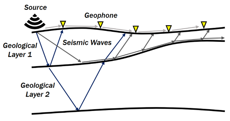
1. Place Geophones:
Small vibration sensors are lined up on the ground.
2. Create a Signal:
A source sends seismic waves into the subsurface.
3. Waves Travel & Reflect:
Waves bounce off underground layers and change direction.
4. Geophones Record the Waves:
They capture the returning signals.
5. Analyze the Data:
We turn the wave patterns into a picture of the underground.
Seismic - How the Method Works
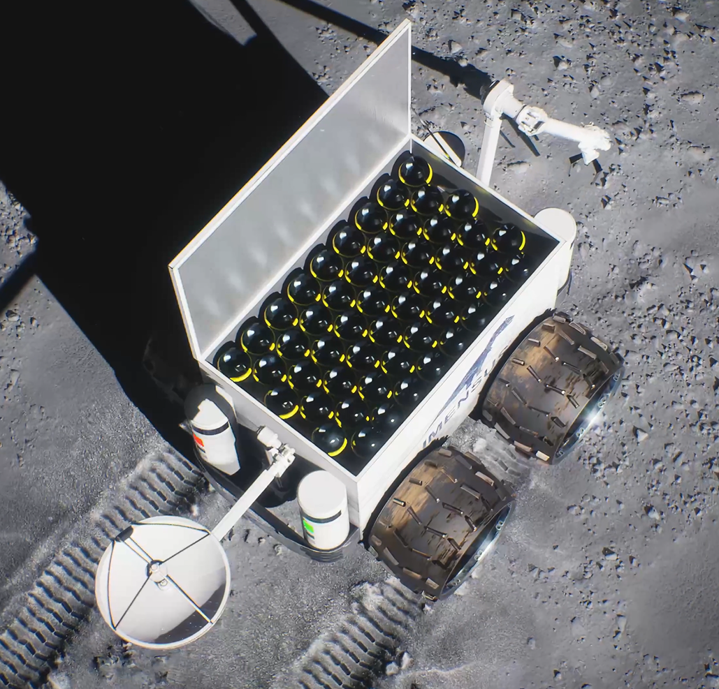
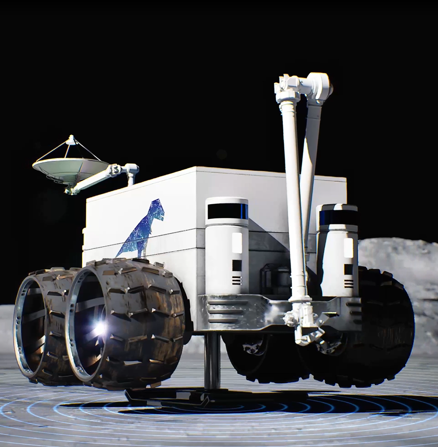
Rover Platform for Seismic Surveys
A purpose-built mobile robot designed to autonomously deploy wireless geophones and seismic sources, trigger vibrations, and record data - optimized for harsh environments and continuous operation.
AI-Driven Autonomous Exploration
Using real-time sensor input and machine learning, the system autonomously navigates terrain, adjusts deployment strategy, and ensures high-quality seismic data without human control on site.
Wireless Geophones with Precision Sensing
Our custom-developed geophones measure ground motion in three axes with high accuracy. Integrated solar charging and rugged housing ensure reliable performance in diverse field conditions.
Robotic Deployment Arm
A fully automated arm installs and retrieves each geophone - applying the correct pressure and angle for optimal coupling with the ground, ensuring precise and repeatable data collection.
Integrated Seismic Source Module
The rover includes an active seismic source capable of generating controlled vibrations. Its modular design allows for different energy levels, depending on the survey depth and geological target.
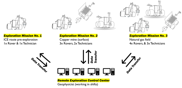
Remote Control Center
All missions are monitored and managed remotely. Our control center oversees rover operation, data quality, and mission safety - enabling expert oversight without sending full field teams.
Lunar R&D: Pushing Boundaries Beyond Earth


While our core focus remains on terrestrial exploration, IMENSUS continues to advance seismic technologies for future lunar missions. Supported by public R&D funding, we adapt and validate key components of the MINTROP system for use in extreme space environments - laying the groundwork for tomorrow’s in-situ resource exploration on the Moon.
Lunar development funded by: